
Planning & Intelligence
GIS Digital Tree Inventory
A location-based inventory that turns individual trees into an actionable property-wide maintenance plan.
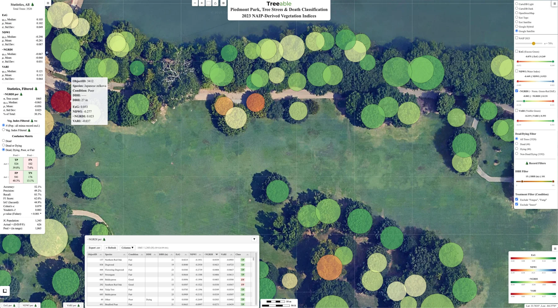
Illustrative Treeable inventory map. Colored tree markers show example product data.
Mapped tree inventory
A location-based view with tree identifiers and the agreed field attributes.
Prioritized recommendations
Condition observations and recommended work organized for review and budgeting.
Connected maintenance history
A record that can link inspections, approved work, photos, and future updates.
What is gis digital tree inventory?
Scope
What this includes
- Tree location and identification
- Species and size information
- Condition and observable defect notes
- Maintenance and risk priority
- Recommended actions and time horizons
- Updates to maintenance history after completed work
One connected record
From a mapped tree to a funded work plan.
Give each tree a location and an identity, then keep the observations, priorities and maintenance history together.
- 01
Locate
Identify the tree and connect it to the property map.
- 02
Record
Capture the agreed attributes, observations and photographs.
- 03
Prioritize
Organize recommendations into practical work groups.
- 04
Update
Connect approved work and future reviews to the same record.
Define the data
Collect what your decisions actually need.
| Record | Management use |
|---|---|
| Tree ID and mapped location | Find the same tree during future inspections and vendor visits. |
| Species and size | Understand the tree population and plan an appropriate maintenance scope. |
| Condition and observations | Identify trees that need attention or a separate risk assessment. |
| Recommended action and priority | Group work for estimating, approvals and scheduling. |
| Inspection and completion history | See what was observed, authorized and completed over time. |
Fields, mapping detail and reporting formats are agreed for your project. This is a scope example, not a sample customer record.
Put it to work
A baseline for budgets, vendors and future reviews.
Use a consistent inventory to discuss priorities with ownership, define vendor scopes and connect completed work to future planning. Across multiple properties, an agreed data standard makes records easier to compare and maintain.
Connect your inventory to a management plan →Start with the right scope.
- One property or a portfolio?
- Every tree or selected priority areas?
- Existing map, survey or spreadsheet?
- Which budget or maintenance decision comes next?
FAQ
GIS Digital Tree Inventory questions
What information is included in a tree inventory?
The exact fields depend on the property, but commonly include location, species, size, condition, observable defects, maintenance recommendations, and priority.
Does every tree need to be inventoried?
Not always. Some properties need a complete inventory, while others benefit from a targeted inventory of priority zones, mature trees, or trees near people and structures.
How often should an inventory be updated?
Update frequency depends on property use, canopy condition, recent storms, construction activity, and the management plan. Completed work should also be added to the maintenance history.
Related
Other services we coordinate
Tree Management Plans
A technology-enabled annual program that connects recurring tree care, emergency readiness, vendor coordination, and year-over-year budgets.
Learn moreRemote Sensing & Canopy Monitoring
Repeat canopy observation using aerial and remote-sensing data to guide field review and long-range planning.
Learn moreFrom a single tree to an entire portfolio, Peachtree brings consistency, accountability, and arborist-led expertise.
Get an EstimateReady to talk about gis digital tree inventory?
Tell us about the property and what you’re seeing. Peachtree helps define the priority, preserves the record, and matches the scope with a credentialed local vendor.